
ファイル:Port Phillip Bay.png
高解像度版はありません。
Port_Phillip_Bay.png (768 × 523 ピクセル、ファイルサイズ: 897キロバイト、MIME タイプ: image/png)
ウィキメディア・コモンズのファイルページにある説明を、以下に表示します。
|
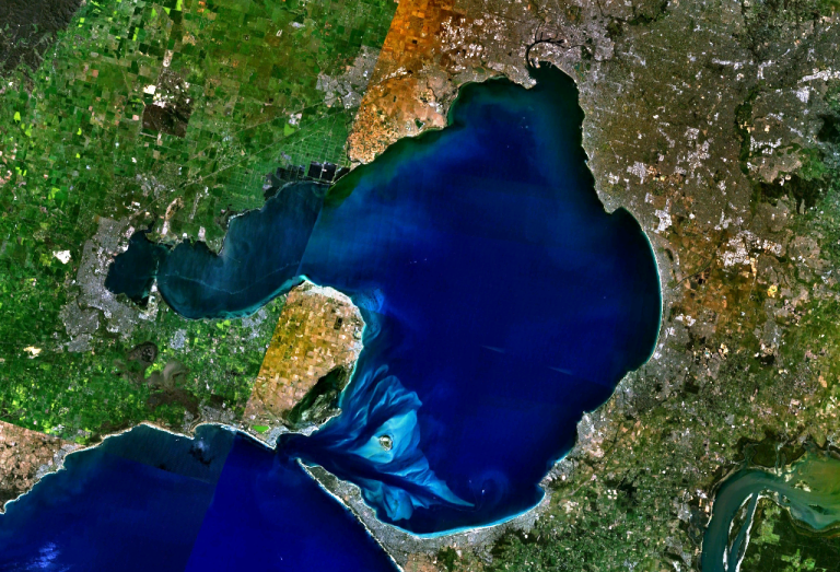
w:Port Phillip Bay, Australia. Melbourne is visible at the head of the bay, Geelong at the head of the western arm, Corio Bay.
| この画像は、Blue Marble、MODIS、Landsat、SRTM、USGS、GLOBEなどのパブリックドメイン・レイヤーを使用したNASAの地球儀ソフトウェア「World Wind」のスクリーンショットであるため、パブリックドメインの状態にあります。
|
 |
ファイルの履歴
過去の版のファイルを表示するには、その版の日時をクリックしてください。
| 日付と時刻 | サムネイル | 寸法 | 利用者 | コメント | |
|---|---|---|---|---|---|
| 現在の版 | 2005年12月28日 (水) 21:56 | | 768 × 523 (897キロバイト) | Stephen Bain | w:Port Phillip Bay, Australia. Melbourne is visible at the head of the bay, Geelong at the head of the western arm, Corio Bay. {{PD-WorldWind}} |
ファイルの使用状況
以下のページがこのファイルを使用しています:
グローバルなファイル使用状況
以下に挙げる他のウィキがこの画像を使っています:
- ar.wikipedia.org での使用状況
- be-tarask.wikipedia.org での使用状況
- be.wikipedia.org での使用状況
- ceb.wikipedia.org での使用状況
- en.wikipedia.org での使用状況
- en.wikivoyage.org での使用状況
- es.wikipedia.org での使用状況
- fi.wikipedia.org での使用状況
- fr.wikipedia.org での使用状況
- ga.wikipedia.org での使用状況
- gl.wikipedia.org での使用状況
- he.wikipedia.org での使用状況
- he.wikivoyage.org での使用状況
- it.wikipedia.org での使用状況
- it.wiktionary.org での使用状況
- lt.wikipedia.org での使用状況
- pl.wikipedia.org での使用状況
- pt.wikipedia.org での使用状況
- ru.wikipedia.org での使用状況
- simple.wikipedia.org での使用状況
- sv.wikipedia.org での使用状況
- uk.wikipedia.org での使用状況
- www.wikidata.org での使用状況