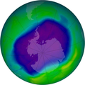
ファイル:NASA and NOAA Announce Ozone Hole is a Double Record Breaker.png

このプレビューのサイズ: 600 × 600 ピクセル。 その他の解像度: 240 × 240 ピクセル | 480 × 480 ピクセル | 716 × 716 ピクセル。
元のファイル (716 × 716 ピクセル、ファイルサイズ: 411キロバイト、MIME タイプ: image/png)
ファイルの履歴
過去の版のファイルを表示するには、その版の日時をクリックしてください。
| 日付と時刻 | サムネイル | 寸法 | 利用者 | コメント | |
|---|---|---|---|---|---|
| 現在の版 | 2012年2月18日 (土) 02:40 |  | 716 × 716 (411キロバイト) | Ras67 | JPEG artifacts mitigated and background removed |
| 2007年8月28日 (火) 20:29 |  | 716 × 716 (409キロバイト) | Nils Simon |
ファイルの使用状況
以下の 3 ページがこのファイルを使用しています:
グローバルなファイル使用状況
以下に挙げる他のウィキがこの画像を使っています:
- af.wikipedia.org での使用状況
- als.wikipedia.org での使用状況
- ar.wikipedia.org での使用状況
- az.wikipedia.org での使用状況
- be.wikipedia.org での使用状況
- bg.wikipedia.org での使用状況
- bn.wikipedia.org での使用状況
- bs.wikipedia.org での使用状況
- ca.wikipedia.org での使用状況
- cs.wikipedia.org での使用状況
- cv.wikipedia.org での使用状況
- de.wikipedia.org での使用状況
- de.wikibooks.org での使用状況
- el.wikipedia.org での使用状況
- en.wikipedia.org での使用状況
- en.wikibooks.org での使用状況
- en.wikinews.org での使用状況
- es.wikipedia.org での使用状況
このファイルのグローバル使用状況を表示する。


