
ファイル:Glasgow UK location map.svg

この SVG ファイルのこの PNG プレビューのサイズ: 588 × 600 ピクセル. その他の解像度: 235 × 240 ピクセル | 471 × 480 ピクセル | 753 × 768 ピクセル | 1,004 × 1,024 ピクセル | 2,008 × 2,048 ピクセル | 1,357 × 1,384 ピクセル。
元のファイル (SVG ファイル、1,357 × 1,384 ピクセル、ファイルサイズ: 1,006キロバイト)
ウィキメディア・コモンズのファイルページにある説明を、以下に表示します。
|
| 解説 |
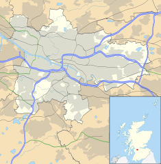
Blank map of Glasgow, UK with the following information shown:
Equirectangular map projection on WGS 84 datum, with N/S stretched 175% Geographic limits:
|
| 日付 | |
| 原典 |
|
| 作者 | Nilfanion, created using Ordnance Survey data |
| 許可 (ファイルの再利用) |
このファイルはクリエイティブ・コモンズ 表示-継承 3.0 非移植ライセンスのもとに利用を許諾されています。 帰属: Contains Ordnance Survey data © Crown copyright and database right
|
| その他のバージョン | File:Glasgow UK blank map.svg - Blank map |
ファイルの履歴
過去の版のファイルを表示するには、その版の日時をクリックしてください。
| 日付と時刻 | サムネイル | 寸法 | 利用者 | コメント | |
|---|---|---|---|---|---|
| 現在の版 | 2012年2月6日 (月) 17:24 | | 1,357 × 1,384 (1,006キロバイト) | Jheald | Updated for M80 and M74 (hand-edited in with Inkscape, tracing a screengrab from OpenStreetmap). |
| 2010年9月26日 (日) 20:15 |  | 1,357 × 1,384 (1,002キロバイト) | Nilfanion | {{Information |Description=Blank map of Glasgow, UK with the following information shown: *Administrative borders *Coastline, lakes and rivers *Roads and railways *Urban areas Equirectangular map projection on WGS 84 datum, with N/S stretch |
ファイルの使用状況
以下の 8 ページがこのファイルを使用しています:
グローバルなファイル使用状況
以下に挙げる他のウィキがこの画像を使っています:
- ar.wikipedia.org での使用状況
- azb.wikipedia.org での使用状況
- az.wikipedia.org での使用状況
- ban.wikipedia.org での使用状況
- bg.wikipedia.org での使用状況
- ceb.wikipedia.org での使用状況
- de.wikipedia.org での使用状況
- Ibrox Stadium
- Hampden Park
- Celtic Park
- Hamilton Crescent
- Firhill Stadium
- Emirates Arena
- Ibrox Park
- OVO Hydro
- Vorlage:Positionskarte Schottland Glasgow
- Scotstoun Stadium
- Glasgow City Heliport
- Springvale Park
- Cathkin Park (1872)
- Hampden Park (1873)
- Cathkin Park (1884)
- Barrowfield Park
- Hyde Park (Glasgow)
- Braehead Park
- Lesser Hampden
- en.wikipedia.org での使用状況
このファイルのグローバル使用状況を表示する。