
ファイル:Changchenmo-Valley-map-by-US-Army-Map-Service.jpg
このプレビューのサイズ: 800 × 409 ピクセル。 その他の解像度: 320 × 164 ピクセル | 640 × 328 ピクセル | 1,024 × 524 ピクセル | 1,280 × 655 ピクセル | 3,449 × 1,765 ピクセル。
元のファイル (3,449 × 1,765 ピクセル、ファイルサイズ: 3.08メガバイト、MIME タイプ: image/jpeg)
ウィキメディア・コモンズのファイルページにある説明を、以下に表示します。
|
概要
| 解説 |
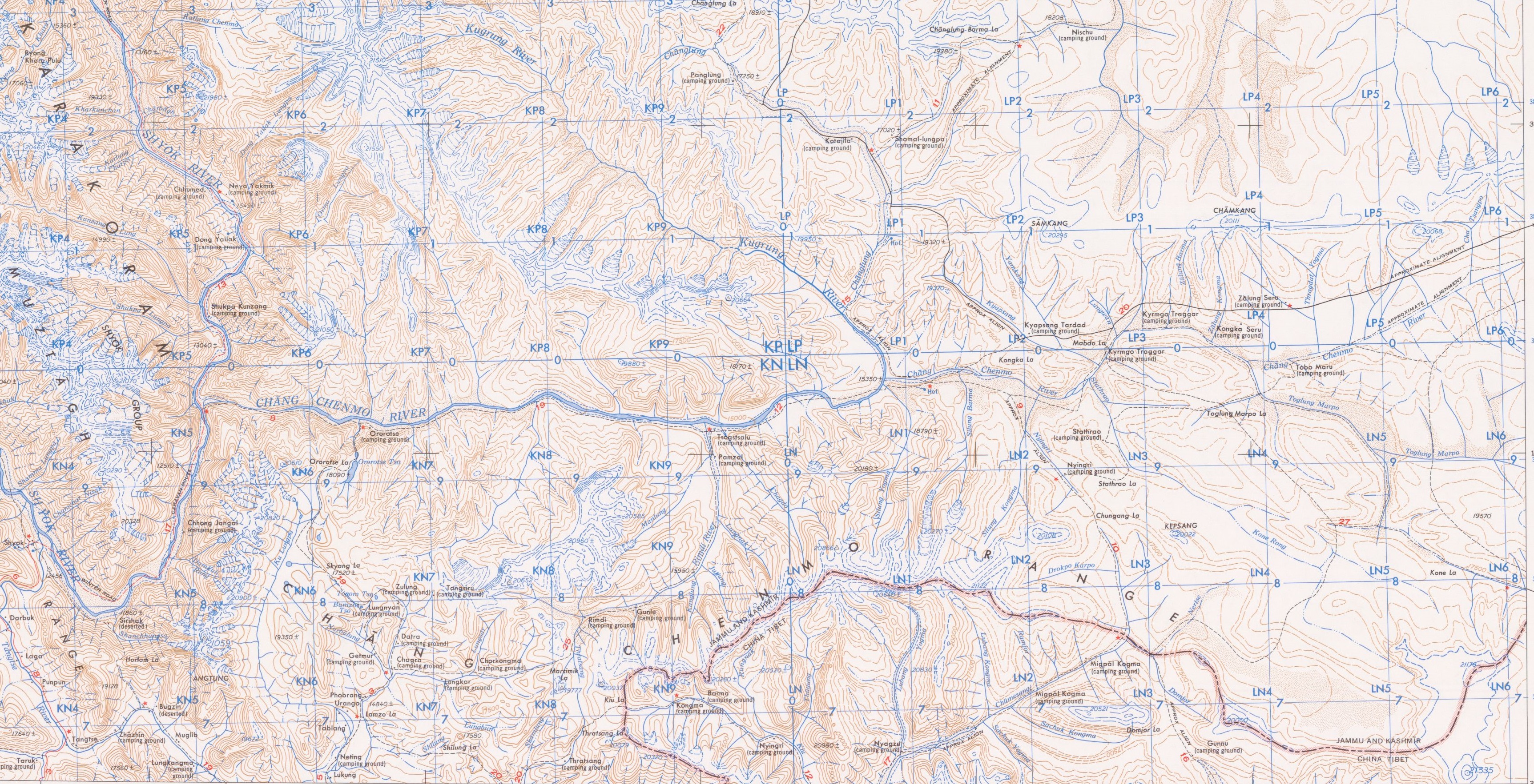
English: Chang Chenmo Valley from the US Army Map Service map NI 44-5 Shyok, 1955. The map shows the Chang Chenmo River and includes the Kongka Pass, Hot Springs. Also shown are a major tributary, Kugrang River, as well as its tributary, Changlung River. The border between Ladakah and Tibet (as known in 1955) runs to the south of the Chang Chenmo Valley, on the crest of the Chang Chenmo Range. It crosses the valley further right at Lanak La (not shown). To the left is the confluence of the Chang Chenmo River with the Shyok River. |
| 日付 | |
| 原典 | https://www.lib.utexas.edu/maps/ams/india/ |
| 作者 | US Army Map Service |
| その他のバージョン |

ライセンス
このファイルは、アメリカ合衆国の連邦政府と雇用関係にある公務員がその職務上作成したアメリカ合衆国政府の著作物であり、アメリカ合衆国の著作権法上パブリックドメインに属します (17 U.S.C. §105)。
注意:このライセンスは、アメリカ合衆国政府の著作物についてのみ効力を有します。アメリカ合衆国の各州、郡、その他の地方自治体が作成した著作物に対しては適用できません。
|
 | |
| このファイルは著作権法の既知の制約(隣接権や関連する権利を含む)から自由であると特定されています。 | ||
ファイルの履歴
過去の版のファイルを表示するには、その版の日時をクリックしてください。
| 日付と時刻 | サムネイル | 寸法 | 利用者 | コメント | |
|---|---|---|---|---|---|
| 現在の版 | 2020年10月30日 (金) 02:54 | | 3,449 × 1,765 (3.08メガバイト) | Kautilya3 | Better cropping of the full map |
| 2020年10月30日 (金) 02:46 |  | 3,233 × 1,509 (2.44メガバイト) | Kautilya3 | Uploaded a work by US Army Map Service from https://www.lib.utexas.edu/maps/ams/india/ with UploadWizard |
ファイルの使用状況
グローバルなファイル使用状況
以下に挙げる他のウィキがこの画像を使っています:
- en.wikipedia.org での使用状況