
ファイル:Virginia Frederick Stephens City.png

このプレビューのサイズ: 743 × 600 ピクセル。 その他の解像度: 297 × 240 ピクセル | 595 × 480 ピクセル | 820 × 662 ピクセル。
元のファイル (820 × 662 ピクセル、ファイルサイズ: 133キロバイト、MIME タイプ: image/png)
ウィキメディア・コモンズのファイルページにある説明を、以下に表示します。
|
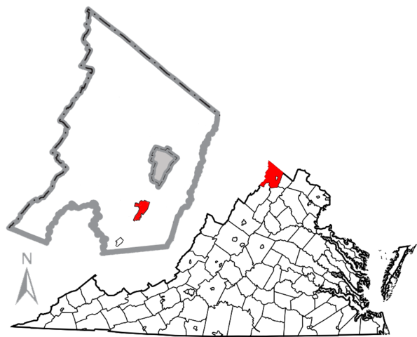
| 解説 | Combination map of Virginia showing Frederick County, originally created by David Benbennick with a map of Frederick County and the town of Stephens City highlighted in red, created by User:JonRidinger. The gray are in the middle of the Frederick County map is the independent city of Winchester. |
| 日付 | (UTC) |
| 原典 | |
| 作者 |
|
この画像には画像編集が施されています。原本に対して次のデジタル的な変更が行われました。
|
このファイルはクリエイティブ・コモンズ 表示 3.0 非移植ライセンスのもとに利用を許諾されています。
- あなたは以下の条件に従う場合に限り、自由に
- 共有 – 本作品を複製、頒布、展示、実演できます。
- 再構成 – 二次的著作物を作成できます。
- あなたの従うべき条件は以下の通りです。
- 表示 – あなたは適切なクレジットを表示し、ライセンスへのリンクを提供し、変更があったらその旨を示さなければなりません。これらは合理的であればどのような方法で行っても構いませんが、許諾者があなたやあなたの利用行為を支持していると示唆するような方法は除きます。
元のアップロードログ
This image is a derivative work of the following images:
- File:Frederick_Stephens_City.png licensed with Cc-by-sa-2.5, Cc-by-sa-3.0-migrated, GFDL, PD-USGov-DOC-Census
- 2010-05-03T03:36:57Z JonRidinger 424x555 (45971 Bytes) Updated boundaries of Stephens City and Middletown using 2010 Boundary and Annexation Survey from [http://www2.census.gov/geo/www/bas/st51_va/cou/c51069_frederick/BAS10C25106900000_000.pdf here]
- 2010-05-02T21:59:28Z JonRidinger 424x555 (45027 Bytes) Minor change in scale
- 2010-05-02T21:52:28Z JonRidinger 424x555 (44965 Bytes) Cleaned up, removed magisterial district borders. [[Category:Maps of Frederick County, Virginia]]
- 2010-05-01T07:03:19Z JonRidinger 424x555 (53079 Bytes) {{Information |Description=Map of Frederick County, Virginia, United States showing [[w:Stephens City, Virginia]]. |Source=*[[:File:Map_of_Frederick_County,_Virginia_with_Municipal_and_District_Labels.png|]] |Date=2010-05-01
- File:Map_of_Virginia_highlighting_Frederick_County.svg licensed with PD-self
- 2006-02-12T17:45:24Z David Benbennick 7486x3247 (228780 Bytes) {{subst:User:Dbenbenn/clm|county=Frederick County|state=Virginia|type=county}}
Uploaded with derivativeFX
ファイルの履歴
過去の版のファイルを表示するには、その版の日時をクリックしてください。
| 日付と時刻 | サムネイル | 寸法 | 利用者 | コメント | |
|---|---|---|---|---|---|
| 現在の版 | 2010年5月7日 (金) 16:32 | | 820 × 662 (133キロバイト) | JonRidinger | {{Information |Description=Combination map of Virginia showing Frederick County, originally created by David Benbennick with a map of Frederick County and the town of [[w:Stephens City, Vi |
ファイルの使用状況
以下のページがこのファイルを使用しています:
グローバルなファイル使用状況
以下に挙げる他のウィキがこの画像を使っています:
- azb.wikipedia.org での使用状況
- en.wikipedia.org での使用状況
- fr.wikipedia.org での使用状況
- it.wikipedia.org での使用状況
- sh.wikipedia.org での使用状況
- simple.wikipedia.org での使用状況