
ファイル:United Arab Emirates. 1870 Johnson Map of Turkey, Persia, Arabia, Balochistan (cropped).jpg

このプレビューのサイズ: 800 × 541 ピクセル。 その他の解像度: 320 × 217 ピクセル | 640 × 433 ピクセル | 1,055 × 714 ピクセル。
元のファイル (1,055 × 714 ピクセル、ファイルサイズ: 317キロバイト、MIME タイプ: image/jpeg)
ウィキメディア・コモンズのファイルページにある説明を、以下に表示します。
|
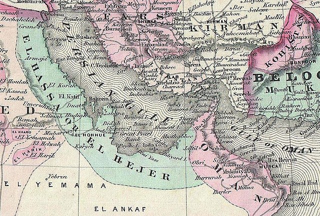
| Alvin Jewett Johnson: Johnson's Turkey in Asia. - Johnson's Persia, Arabia, Beloochistan and Afghanistan.
( |
|||||||||||||||||||||||
|---|---|---|---|---|---|---|---|---|---|---|---|---|---|---|---|---|---|---|---|---|---|---|---|
| 作者 |
|
||||||||||||||||||||||
| タイトル |
Johnson's Turkey in Asia. - Johnson's Persia, Arabia, Beloochistan and Afghanistan. |
||||||||||||||||||||||
| 解説 |
English: This is A. J. Johnson 1870 map of what is today considered the Middle East, in Western Asia.
|
||||||||||||||||||||||
| 日付 | 1867年 (dated) | ||||||||||||||||||||||
| 寸法 | 高さ: 23 in (58.4 cm);幅: 15.5 in (39.3 cm) | ||||||||||||||||||||||
| 台帳番号 |
Geographicus link: TurkeyPersiaArabia-johnson-1870 |
||||||||||||||||||||||
| 情報源/撮影者 |
Johnson, A. J., Johnson's New Illustrated Family Atlas. (1870 A. J. Johnson edition)
|
||||||||||||||||||||||
| 許可 (ファイルの再利用) |
|
||||||||||||||||||||||
| その他のバージョン | |||||||||||||||||||||||

_-_Geographicus_-_TurkeyPersiaArabia-johnson-1870.jpg)
.jpg?uselang=ja)
.jpg?uselang=ja)
.jpg?uselang=ja&action=history)
.jpg)
ファイルの履歴
過去の版のファイルを表示するには、その版の日時をクリックしてください。
| 日付と時刻 | サムネイル | 寸法 | 利用者 | コメント | |
|---|---|---|---|---|---|
| 現在の版 | 2020年9月15日 (火) 15:43 | | 1,055 × 714 (317キロバイト) | Geagea | File:1870 Johnson Map of Turkey, Persia, Arabia, Balochistan.jpg cropped 69 % horizontally, 72 % vertically using CropTool with precise mode. |
ファイルの使用状況
以下のページがこのファイルを使用しています:
グローバルなファイル使用状況
以下に挙げる他のウィキがこの画像を使っています:
- en.wikipedia.org での使用状況
- pl.wikipedia.org での使用状況
- vi.wikipedia.org での使用状況
.jpg)