
ファイル:Poland & The New Baltic States.jpg
このプレビューのサイズ: 462 × 599 ピクセル。 その他の解像度: 185 × 240 ピクセル | 370 × 480 ピクセル | 592 × 768 ピクセル | 790 × 1,024 ピクセル | 1,376 × 1,784 ピクセル。
元のファイル (1,376 × 1,784 ピクセル、ファイルサイズ: 1.22メガバイト、MIME タイプ: image/jpeg)
ウィキメディア・コモンズのファイルページにある説明を、以下に表示します。
|
| 解説 |
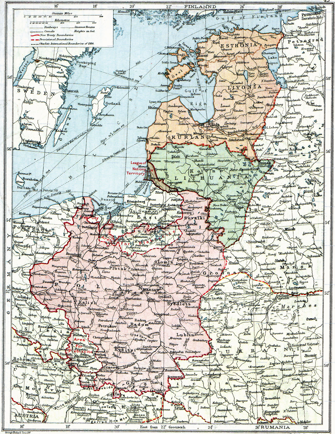
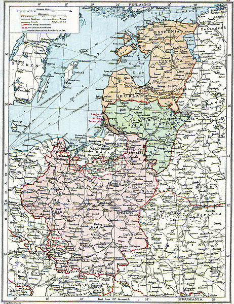
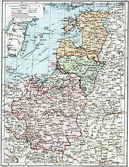
English: Map of Poland, en:Lithuania, en:Courland, en:Livonia and en:Esthonia published in the 1920 edition of The Peoples Atlas by London Geographical Institute.
The map shows the situation after the treaties of Versailles and Brest-Litovsk and before the en:Peace of Riga and the organization and recognition of the nation-states of en:Estonia and en:Latvia. Note that most names featured on this map are pre-1914 Russian names put in English transcription, rather than local or English names as such. |
| 日付 | |
| 原典 |
This uploaded map is a photoshopped version of the original image located at Image:London-geographical-institute the-peoples-atlas 1920 poland-and-the-new-baltic-states.jpg or [1]. Originally uploaded to EN Wikipedia as en:Image:Poland & The New Baltic States.jpg by en:User:MaGioZal 26 December 2007 |
| 作者 | London Geographical Institute |
| 許可 (ファイルの再利用) |
According to the site, there are no copyrights to this map. |
| その他のバージョン | Image:London-geographical-institute the-peoples-atlas 1920 poland-and-the-new-baltic-states.jpg |
このファイルはアメリカ合衆国においてパブリックドメインの状態にあります。これは多くの場合、最初の公表が1929年1月1日以前であるために著作権が消滅したアメリカ合衆国の著作物に適用されます。より詳細な説明については、このページをご覧ください。
|
 | |
 |
このファイルはアメリカ合衆国以外ではパブリックドメインの状態にはない可能性があり、この点は、特に、カナダ、中華人民共和国(香港・マカオを除く)、ドイツ、メキシコ及びスイスのようにアメリカ合衆国の著作物の著作権の保護期間について相互主義を採用していない国・地域で当てはまります。作者や公表年は必要な情報であり、条件とされるべきものです。詳細についてはWikipedia:Public domain及びWikipedia:Copyrightsをご覧ください。
|
ファイルの履歴
過去の版のファイルを表示するには、その版の日時をクリックしてください。
| 日付と時刻 | サムネイル | 寸法 | 利用者 | コメント | |
|---|---|---|---|---|---|
| 現在の版 | 2010年6月26日 (土) 14:06 | | 1,376 × 1,784 (1.22メガバイト) | Ras67 | losslessly cropped with Jpegcrop |
| 2008年8月3日 (日) 07:47 |  | 1,506 × 1,996 (1.28メガバイト) | Rcbutcher | {{Information |Description=Map of Poland, Lithuania, Courland, Livonia and Esthonia published in the 1920 edition of ''The Peoples Atlas'' by London Geographical Institute. The map shows the situation after the treaties of [[Treaty of |
ファイルの使用状況
以下の 2 ページがこのファイルを使用しています:
グローバルなファイル使用状況
以下に挙げる他のウィキがこの画像を使っています:
- ar.wikipedia.org での使用状況
- bat-smg.wikipedia.org での使用状況
- ba.wikipedia.org での使用状況
- ca.wikipedia.org での使用状況
- da.wikipedia.org での使用状況
- de.wikipedia.org での使用状況
- en.wikipedia.org での使用状況
- et.wikipedia.org での使用状況
- fi.wikipedia.org での使用状況
- fr.wikipedia.org での使用状況
- gl.wikipedia.org での使用状況
- it.wikipedia.org での使用状況
- lt.wikipedia.org での使用状況
- lt.wikibooks.org での使用状況
- lv.wikipedia.org での使用状況
- no.wikipedia.org での使用状況
- ro.wikipedia.org での使用状況
- ru.wikipedia.org での使用状況
- sl.wikipedia.org での使用状況
- sr.wikipedia.org での使用状況
- sv.wikipedia.org での使用状況
- tr.wikipedia.org での使用状況
このファイルのグローバル使用状況を表示する。