
ファイル:Map of Alabama highlighting Perry County.svg

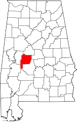
この SVG ファイルのこの PNG プレビューのサイズ: 379 × 600 ピクセル. その他の解像度: 152 × 240 ピクセル | 303 × 480 ピクセル | 485 × 768 ピクセル | 647 × 1,024 ピクセル | 1,294 × 2,048 ピクセル | 3,379 × 5,346 ピクセル。
元のファイル (SVG ファイル、3,379 × 5,346 ピクセル、ファイルサイズ: 94キロバイト)
ウィキメディア・コモンズのファイルページにある説明を、以下に表示します。
|
概要
| 解説 |
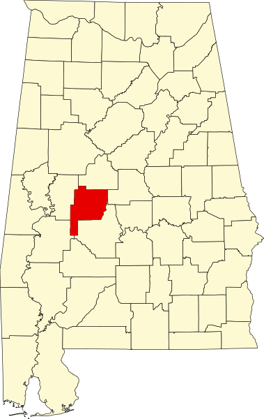
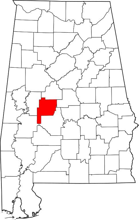
English: This is a locator map showing Perry County in Alabama. For more information, see Commons:United States county locator maps. |
| 日付 | |
| 原典 |
投稿者自身による著作物: English: The maps use data from nationalatlas.gov, specifically countyp020.tar.gz on the Raw Data Download page. The maps also use state outline data from statesp020.tar.gz. The Florida maps use hydrogm020.tar.gz to display Lake Okeechobee. |
| 作者 | David Benbennick |
ライセンス
| この著作物の著作権者である私は、この著作物における権利を放棄しパブリックドメインとします。これは全世界で適用されます。 一部の国では、これが法的に可能ではない場合があります。その場合は、次のように宣言します。 私は、あらゆる人に対して、法により必要とされている条件を除き、如何なる条件も課すことなく、あらゆる目的のためにこの著作物を使用する権利を与えます。 |
ファイルの履歴
過去の版のファイルを表示するには、その版の日時をクリックしてください。
| 日付と時刻 | サムネイル | 寸法 | 利用者 | コメント | |
|---|---|---|---|---|---|
| 現在の版 | 2006年2月12日 (日) 09:53 | | 3,379 × 5,346 (94キロバイト) | David Benbennick | {{subst:User:Dbenbenn/clm|county=Perry County|state=Alabama}} |
ファイルの使用状況
以下の 2 ページがこのファイルを使用しています:
グローバルなファイル使用状況
以下に挙げる他のウィキがこの画像を使っています:
- ar.wikipedia.org での使用状況
- az.wikipedia.org での使用状況
- bg.wikipedia.org での使用状況
- bpy.wikipedia.org での使用状況
- ca.wikipedia.org での使用状況
- cdo.wikipedia.org での使用状況
- ceb.wikipedia.org での使用状況
- ce.wikipedia.org での使用状況
- cy.wikipedia.org での使用状況
- de.wikipedia.org での使用状況
- en.wikipedia.org での使用状況
- List of counties in Alabama
- Perry County, Alabama
- Marion, Alabama
- Uniontown, Alabama
- Judson College (Alabama)
- National Register of Historic Places listings in Perry County, Alabama
- Lincoln Normal School
- Heiberger, Alabama
- Marion Military Institute
- Template:Perry County, Alabama
- Kenworthy Hall
- Pitts' Folly
- Sprott, Alabama
- User:Nyttend/County templates/AL
- Westwood (Uniontown, Alabama)
- Marion Courthouse Square Historic District
- Uniontown Historic District (Uniontown, Alabama)
- Fairhope Plantation
- Siloam Baptist Church
- Category:Populated places in Perry County, Alabama
- West Marion Historic District
- Folsom, Perry County, Alabama
- First Congregational Church of Marion
- Template:NRHP in Perry County, Alabama
- Bryand Brand House
- Moore-Webb-Holmes Plantation
- Green Street Historic District (Marion, Alabama)
- Henry House (Marion, Alabama)
- Adler, Alabama
- Augustin, Alabama
- Hamburg, Alabama
- Jericho, Alabama
- Levert, Alabama
- Morgan Springs, Alabama
- Oakmulgee, Alabama
このファイルのグローバル使用状況を表示する。