
ファイル:Lascar The Meridian Gate (4473846693).jpg
このプレビューのサイズ: 800 × 531 ピクセル。 その他の解像度: 320 × 213 ピクセル | 640 × 425 ピクセル | 1,024 × 680 ピクセル | 1,280 × 850 ピクセル | 2,560 × 1,700 ピクセル | 3,216 × 2,136 ピクセル。
元のファイル (3,216 × 2,136 ピクセル、ファイルサイズ: 2.76メガバイト、MIME タイプ: image/jpeg)
ウィキメディア・コモンズのファイルページにある説明を、以下に表示します。
|
.jpg?uselang=ja)
.jpg?uselang=ja)
.jpg?uselang=ja&action=history)
.jpg)
概要
| 解説 |
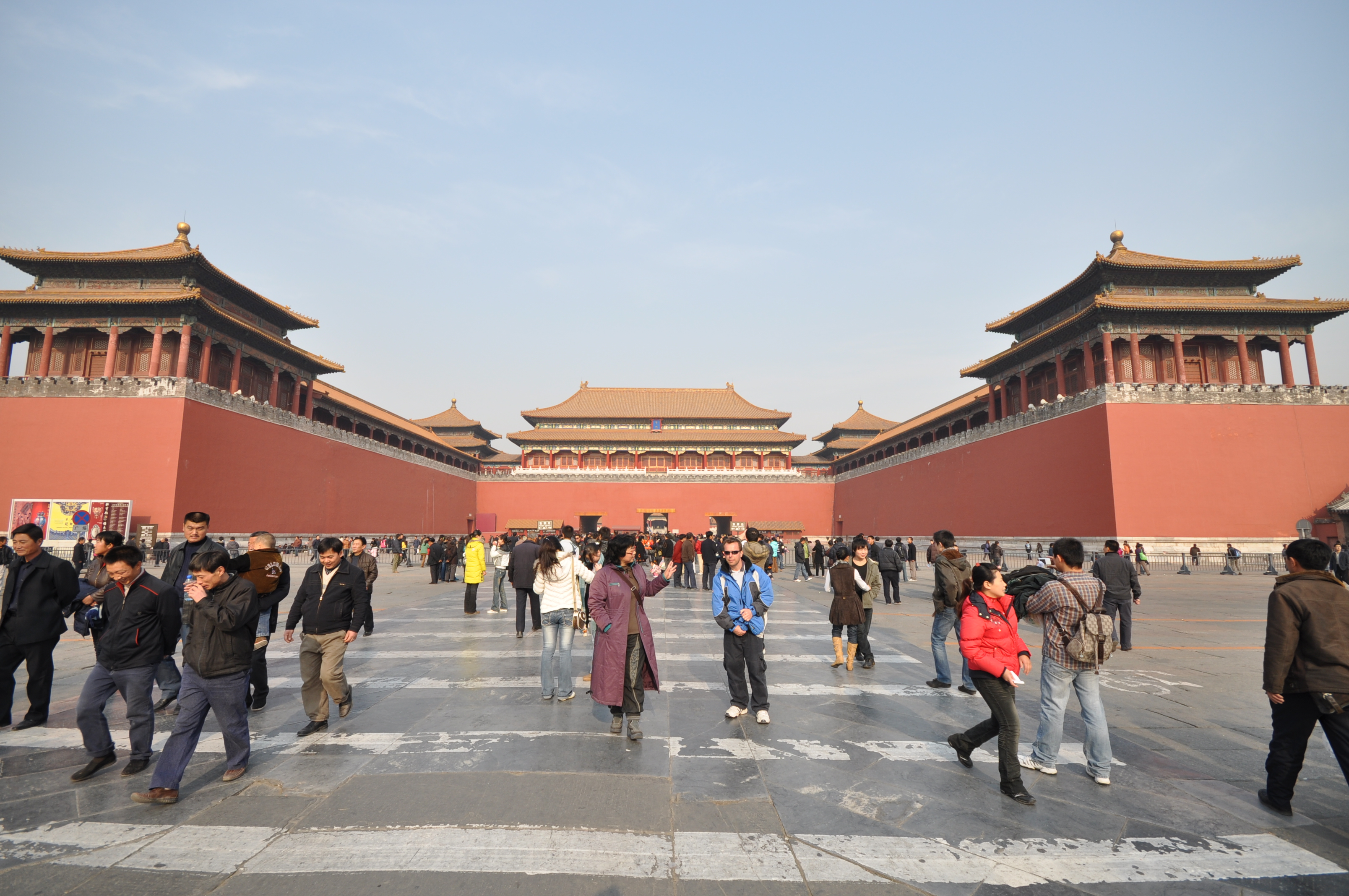
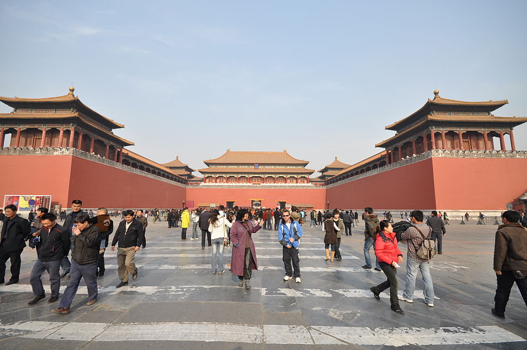
"Wu men" English: Beijing - Forbidden City(view N) - Meridian Gate -
The Meridian Gate is the southern (and largest) gate of the Forbidden City. It has five arches. The three central arches are close together; the two flanking arches are farther apart from the three central arches. The center arch was formerly reserved for the Emperor alone; the exceptions were the Empress, who could enter it once on the day of her wedding, and the top three scholars of the triennial civil service examinations, who left the exams through the central arch. All other officials and servants had to use the four side arches. Above the arches are a series of buildings. The central one is the palace of nine bays wide, with double roofs. In each side, the 13 bays-wide building, single roof, connects the two pavilions on the top. The Emperor of China reviewed his troops from this location during the Ming and Qing dynasties. Its superstructure is also called the "Five Phoenix Turrets" because it is composed of five buildings.[1] Imperial proclamations and almanacs were issued from the gate house. After successful campaigns, the Emperor received prisoners of war here, sometimes followed by mass decapitations.[2] The gate has five gateways. Although urban myth has it that senior officers were executed here in Imperial China; in reality only corporal punishment was actually carried out. Behind the viewer is Tiananmen Gate, the principal entrance to the imperial palace grounds. When proceeding northward through the palace grounds, the next major gate encountered is the Gate of Supreme Harmony. [Wikipedia.org]
Deutsch: Beijing - Verbotene Stadt(Blick N) - Mittagstor |
| 日付 | |
| 原典 | The Meridian Gate |
| 作者 | Jorge Láscar from Australia |
| カメラの位置 | | 以下のサービスでこの位置を確認する: オープンストリートマップ |
|---|
.jpg¶ms=039.907925_N_0116.390919_E_globe:Earth_type:camera_source:Flickr_&language=ja)
ライセンス
このファイルはクリエイティブ・コモンズ 表示 2.0 一般ライセンスのもとに利用を許諾されています。
- あなたは以下の条件に従う場合に限り、自由に
- 共有 – 本作品を複製、頒布、展示、実演できます。
- 再構成 – 二次的著作物を作成できます。
- あなたの従うべき条件は以下の通りです。
- 表示 – あなたは適切なクレジットを表示し、ライセンスへのリンクを提供し、変更があったらその旨を示さなければなりません。これらは合理的であればどのような方法で行っても構いませんが、許諾者があなたやあなたの利用行為を支持していると示唆するような方法は除きます。
| この画像は当初、Jorge Lascar によって Flickr の https://www.flickr.com/photos/8721758@N06/4473846693 に投稿されたものです。2014-04-02、FlickreviewR ボットによってレビューされ、cc-by-2.0 のライセンスで提供されていることが確認されました。 |
ファイルの履歴
過去の版のファイルを表示するには、その版の日時をクリックしてください。
| 日付と時刻 | サムネイル | 寸法 | 利用者 | コメント | |
|---|---|---|---|---|---|
| 現在の版 | 2014年4月2日 (水) 09:25 | | 3,216 × 2,136 (2.76メガバイト) | Russavia | Transferred from Flickr |
ファイルの使用状況
以下のページがこのファイルを使用しています:
.jpg)