
ファイル:Johnson 1920 HighPlains.jpg

このプレビューのサイズ: 788 × 600 ピクセル。 その他の解像度: 316 × 240 ピクセル | 631 × 480 ピクセル | 1,010 × 768 ピクセル | 1,280 × 974 ピクセル | 2,560 × 1,948 ピクセル | 4,169 × 3,172 ピクセル。
元のファイル (4,169 × 3,172 ピクセル、ファイルサイズ: 6.37メガバイト、MIME タイプ: image/jpeg)
ウィキメディア・コモンズのファイルページにある説明を、以下に表示します。
|
| 解説 |
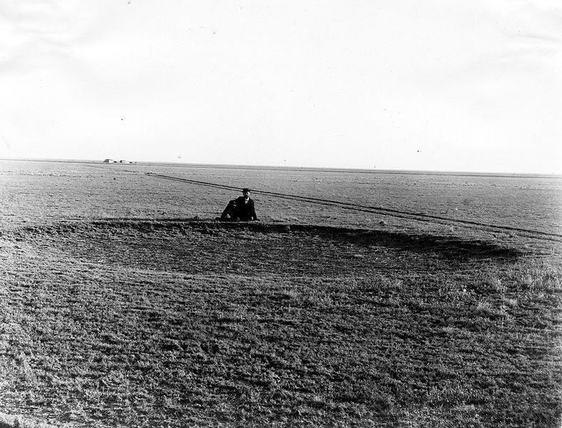
English: Appears as Plate II in: Darton, N.H. 1920. Syracuse-Lakin folio, Kansas. United States Department of the Interior, U.S. Geological Survey, Folios of the Geologic Atlas, no. 212. Original caption: Typical surface of the country underlain by the Ogallala formation of the High Plains of western Kansas. Buffalo wallow, shallow circular depression in the level surface, in foreground. Photo date is 1897 and location is Haskell County, Kansas. |
|||
| 日付 | ||||
| 原典 | U.S. Geological Survey Photographic Library, http://libraryphoto.cr.usgs.gov/ | |||
| 作者 | Willard Drake Johnson | |||
| 許可 (ファイルの再利用) |
|
ファイルの履歴
過去の版のファイルを表示するには、その版の日時をクリックしてください。
| 日付と時刻 | サムネイル | 寸法 | 利用者 | コメント | |
|---|---|---|---|---|---|
| 現在の版 | 2008年12月20日 (土) 21:42 | | 4,169 × 3,172 (6.37メガバイト) | Leaflet | {{Information |Description={{en|1=Typical surface of the country underlain by the Ogahalla formation of the high plains of western Kansas, buffalo wallow; shallow circular depression in the level surface, in foreground. Haskell County, Kansas. 1897. Plate |
ファイルの使用状況
以下のページがこのファイルを使用しています:
グローバルなファイル使用状況
以下に挙げる他のウィキがこの画像を使っています:
- arz.wikipedia.org での使用状況
- ca.wikipedia.org での使用状況
- en.wikipedia.org での使用状況
- he.wikipedia.org での使用状況
- ka.wikipedia.org での使用状況
- simple.wikipedia.org での使用状況
- vi.wikipedia.org での使用状況