
ファイル:Hartford KY tornado damage.jpg
このプレビューのサイズ: 800 × 450 ピクセル。 その他の解像度: 320 × 180 ピクセル | 640 × 360 ピクセル | 1,024 × 576 ピクセル | 1,280 × 720 ピクセル | 2,560 × 1,440 ピクセル | 4,032 × 2,268 ピクセル。
元のファイル (4,032 × 2,268 ピクセル、ファイルサイズ: 1.09メガバイト、MIME タイプ: image/jpeg)
ウィキメディア・コモンズのファイルページにある説明を、以下に表示します。
|
概要
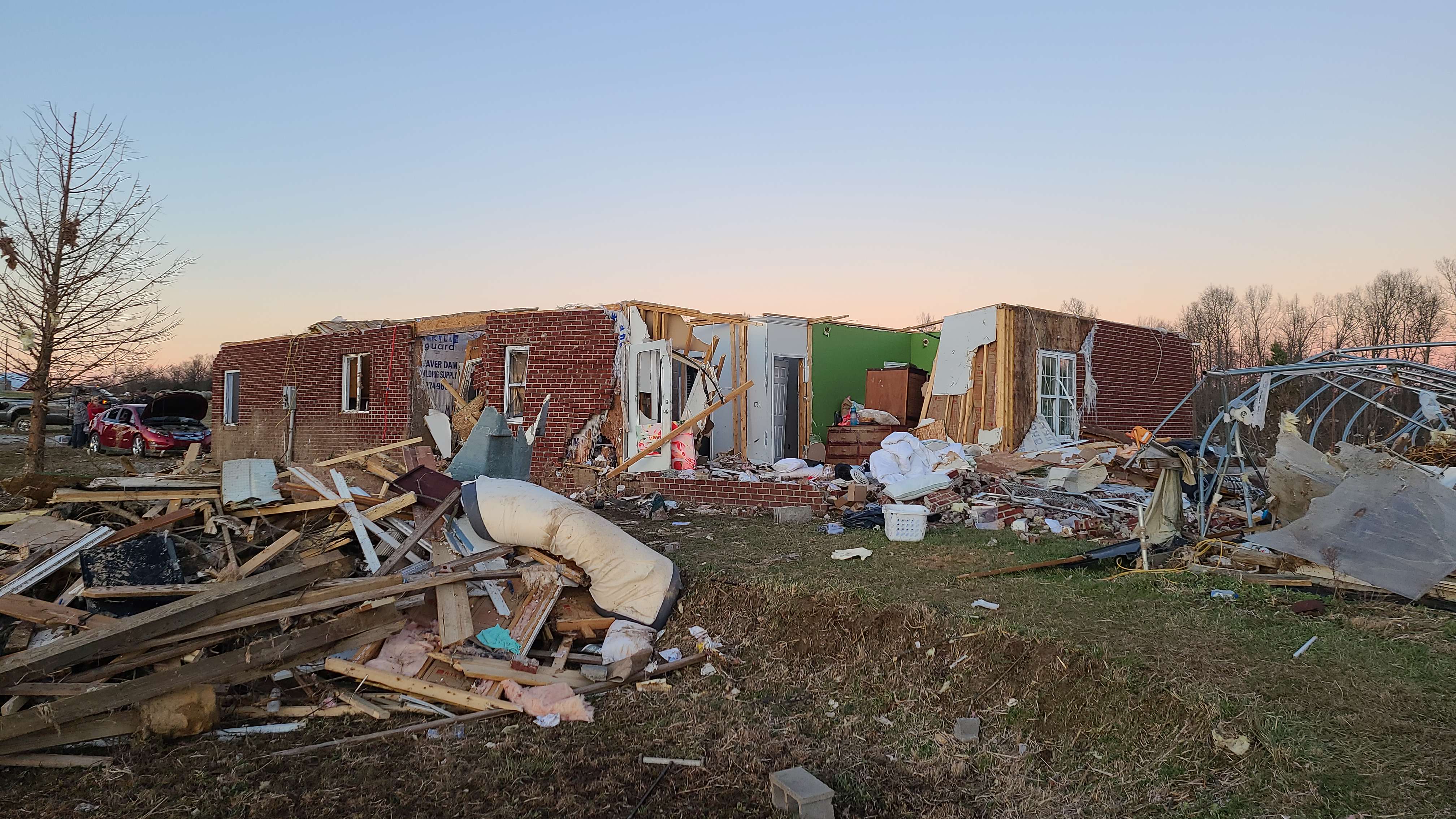
| 解説 | Major structural damage to a house near Hartford, Kentucky. |
| 日付 | |
| 原典 | https://apps.dat.noaa.gov/stormdamage/damageviewer/ |
| 作者 | NWS Louisville |
| 許可 (ファイルの再利用) |
National Weather Service |
| カメラの位置 | | 以下のサービスでこの位置を確認する: オープンストリートマップ |
|---|
ライセンス
This image is in the public domain because it was stored on the web servers of the U.S. National Weather Service. NWS-created images are automatically public domain in the U.S. since the NWS is a part of the U.S. government. However, the NWS sites also host non-NWS images which have been submitted by individuals: these are generally shown as "Courtesy of ...". Such images have explicitly been released to the public domain by the copyright owner as part of the upload process.
As stated at https://www.weather.gov/fsd/disclaimer: "By submitting images, you understand that your image is being released into the public domain. This means that your photo or video may be downloaded, copied, and used by others." Thus, all* images on NWS servers are public domain (including "Courtesy of ..." and “Photo by ...” images) unless specifically stated otherwise through a copyright (©) watermark.
*A deletion discussion in November 2023 ruled that Getty Images on the web servers of NWS, are to be considered copyrighted, even without a copyright (©) watermark and are the sole exception to this rule.
|
ファイルの履歴
過去の版のファイルを表示するには、その版の日時をクリックしてください。
| 日付と時刻 | サムネイル | 寸法 | 利用者 | コメント | |
|---|---|---|---|---|---|
| 現在の版 | 2022年1月6日 (木) 05:07 | | 4,032 × 2,268 (1.09メガバイト) | TornadoInformation12 | {{Information |Description=Major structural damage to a house near Hartford, Kentucky. |Source=https://apps.dat.noaa.gov/stormdamage/damageviewer/ |Date=December 12, 2021 |Author=NWS Louisville |Permission=National Weather Service |other_versions= }} |
ファイルの使用状況
以下のページがこのファイルを使用しています:
グローバルなファイル使用状況
以下に挙げる他のウィキがこの画像を使っています:
- en.wikipedia.org での使用状況