
ファイル:Baltimore-Washington TAC 82.png

このプレビューのサイズ: 800 × 589 ピクセル。 その他の解像度: 320 × 235 ピクセル | 640 × 471 ピクセル | 1,024 × 753 ピクセル | 1,280 × 942 ピクセル | 2,560 × 1,884 ピクセル | 4,000 × 2,943 ピクセル。
元のファイル (4,000 × 2,943 ピクセル、ファイルサイズ: 6.85メガバイト、MIME タイプ: image/png)
ウィキメディア・コモンズのファイルページにある説明を、以下に表示します。
|
| 解説 |
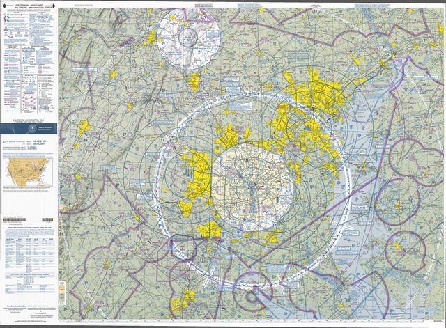
English: VFR Terminal Area Raster Aeronautical Chart Baltimore/Washington, 82nd edition. This map is valid until 2011年7月28日, be sure to get the newest edition at the official FAA website |
| 日付 |
|
| 原典 | Baltimore-Washington_TAC_82.tif in Baltimore-Washington_TAC_82.zip. Note: The ZIP-File may become unavailable when the map is updated, newer editions will be available here |
| 作者 | US Department of Transportation, Federal Aviation Administration, National Aeronautical Navigation Services |
| その他のバージョン |
This image or file is a work of a Federal Aviation Administration employee, taken or made as part of that person's official duties. As a work of the U.S. federal government, the image is in the public domain in the United States.
|
 |
ファイルの履歴
過去の版のファイルを表示するには、その版の日時をクリックしてください。
| 日付と時刻 | サムネイル | 寸法 | 利用者 | コメント | |
|---|---|---|---|---|---|
| 現在の版 | 2011年4月27日 (水) 12:54 | | 4,000 × 2,943 (6.85メガバイト) | El Grafo | smaller version to enable thumbnails |
| 2011年4月27日 (水) 12:49 |  | 8,000 × 5,885 (25.57メガバイト) | El Grafo | {{Information |Description={{en|1=VFR Terminal Area Raster Aeronautical Chart Baltimore/Washington, 82nd edition. This map is valid until {{date|2011|07|28}}, be sure to get the newest edition at the official [http://aeronav.faa.gov/index.asp?xml=aeronav/ |
ファイルの使用状況
以下の 2 ページがこのファイルを使用しています:
グローバルなファイル使用状況
以下に挙げる他のウィキがこの画像を使っています:
- bg.wikipedia.org での使用状況
- de.wikipedia.org での使用状況
- en.wikipedia.org での使用状況
- fa.wikipedia.org での使用状況
- fi.wikipedia.org での使用状況
- oc.wikipedia.org での使用状況
- vi.wikipedia.org での使用状況