
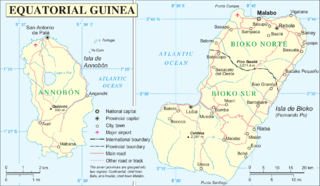
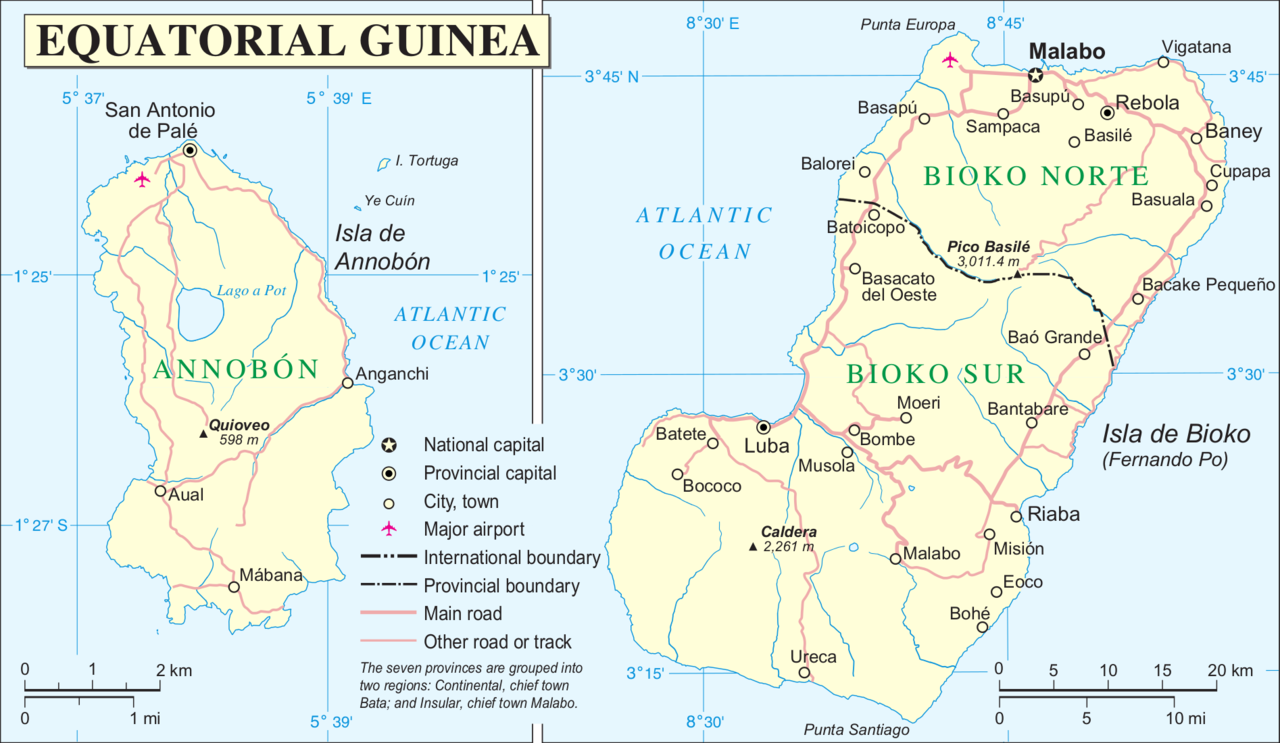
ファイル:Annobón Bioko.PNG

元のファイル (1,894 × 1,100 ピクセル、ファイルサイズ: 502キロバイト、MIME タイプ: image/png)
ウィキメディア・コモンズのファイルページにある説明を、以下に表示します。
|
概要
| 解説 | |
| 日付 | |
| 原典 | http://www.un.org/Depts/Cartographic/map/profile/eqguinea.pdf |
| 作者 | |
| その他のバージョン |
このファイルの派生的著作物: |
ライセンス
| This image is a map derived from a United Nations map.
Unless stated otherwise, UN maps are to be considered in the public domain. This applies worldwide. UN maps are, in principle, open source material and you can use them in your work or for making your own map. UN requests however that you delete the UN name, logo and reference number upon any modification to the map. Content of your map will be your responsibility. You can state in your publication, if you wish, something like: based on UN map … (map name, map number, revision number and date). See: Geospatial Information Section. And: Geospatial, location data for a better world. |
 |
ファイルの履歴
過去の版のファイルを表示するには、その版の日時をクリックしてください。
| 日付と時刻 | サムネイル | 寸法 | 利用者 | コメント | |
|---|---|---|---|---|---|
| 現在の版 | 2016年6月15日 (水) 19:12 | | 1,894 × 1,100 (502キロバイト) | W like wiki | + lower margin |
| 2016年6月15日 (水) 17:26 |  | 1,895 × 1,098 (501キロバイト) | W like wiki | Now all coordinates are more clear: E for EAST, N for NORTH, S for SOUTH !!! | |
| 2016年6月15日 (水) 17:04 |  | 1,895 × 1,098 (500キロバイト) | W like wiki | link=|55px Even though the source of this file is the UN, the lower latitude coordinates of Annobón (located on the southern hemisphere!) seems to be '''wrong''', so '''1°27′''' is now used instead of '''1°23... | |
| 2014年9月7日 (日) 11:05 |  | 1,895 × 1,098 (499キロバイト) | Basquetteur | Corrected to amend wrong spelling of Bioko (Isla de Boiko in original UN map) and also uploading a higher resolution version | |
| 2005年5月20日 (金) 03:47 |  | 946 × 553 (88キロバイト) | Taichi | Mapa de Annobón y Bioko. Guinea Ecuatorial {{PD}} Fuente: http://www.un.org/Depts/Cartographic/map/profile/eqguinea.pdf |
ファイルの使用状況
以下のページがこのファイルを使用しています:
グローバルなファイル使用状況
以下に挙げる他のウィキがこの画像を使っています:
- an.wikipedia.org での使用状況
- azb.wikipedia.org での使用状況
- de.wikipedia.org での使用状況
- en.wikipedia.org での使用状況
- eo.wikipedia.org での使用状況
- es.wikipedia.org での使用状況
- et.wikipedia.org での使用状況
- fr.wikipedia.org での使用状況
- gl.wikipedia.org での使用状況
- it.wikipedia.org での使用状況
- ko.wikipedia.org での使用状況
- ml.wikipedia.org での使用状況
- pl.wikipedia.org での使用状況
- pt.wikipedia.org での使用状況
- ru.wikipedia.org での使用状況
- sco.wikipedia.org での使用状況
- sh.wikipedia.org での使用状況
- uk.wikipedia.org での使用状況
- ur.wikipedia.org での使用状況
- vi.wikipedia.org での使用状況
- wuu.wikipedia.org での使用状況
- zh.wikipedia.org での使用状況
- zu.wikipedia.org での使用状況